Upper Stret East Bank
A tributary of the Stret that comes from The Artery Valley empties into The Stret River in the northwest of this zone.
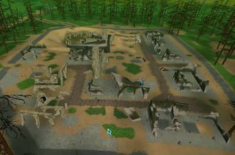
The rubble and ruins of Safe Haven Town lie to the northeast. The town's Bank and Mission terminals are either anamolous, or a tribute to the sturdy construction of these machines.
The Anarchy Online logo is etched onto a hill in this zone at coordinates 989 x 2254.
There is one Omni-Tek outpost in the northwest, and one in the southwest
Three Fixer Grid exits lead to the northwest, east, and south of the zone
The zone is bordered by Stret West Bank to the west, Central Artery Valley to the east, Stret East Bank to the south, and a very narrow pass to Varmint Woods to the north.
There are no normal Grid exits or whompahs in Upper East Stret Bank
Land Control Areas[edit]
|
|
Map Upgrades[edit]
![]() Map requirement: 240
Map requirement: 240
Players may buy the map upgrade 'Upper Stret East Bank', to enable them to see all features of this zone on the PF Map. The Map Navigation skill requirement to upload this map is 240.
Mobs[edit]
Sightseeing[edit]

